Description:
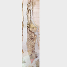
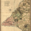
The most accessible print room in New York City, the Print Collection of The New York Public Library encompasses over 200,000 prints along with a specialized reference collection of over 15,000 volumes on the history of prints and printmakers. Included in this collection is the Commissioner's Map of 1811 (near right) depicting the original design for Manhattan's grid that established the current street plan. Far right, Bernard Ratzer's Map reveals the presence of 30,000 residents below Chambers Street by 1767 while Viele's 1874 map depicts original topography.
The New York Public Library is also home to the Lionel Pincus and Princess Firyal Map Division, one of the world's premier map collections in terms of size, scope, unique holdings, diversity and intensity of use. Established in 1898, its holdings include more than 433,000 sheet maps and 20,000 books and atlases published between the 15th and 21st centuries. The collections range from the global to the local scale and support the learning and research needs of a wide variety of users.
Credits:
New York Public Library
digitalgallery.nypl.org
Stephen A. Schwarzman Building / Print Collection, Miriam and Ira D. Wallach Division of Art, Prints and Photographs.
Lionel Pincus and Princesss Firyal Map Division


British Headquarters-Map 24


