Description:
OASIS is an Open Accessible Space Information System developed and launched in early 2001 by the CUNY Mapping Service at the Center for Urban Research that provides community maps for New York City. The maps place open space, community gardens, property information, and transportation networks on interactive sites for viewers to witness changes in the cityscape, see their own property information or zoning districts, or landmarked sited.
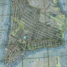
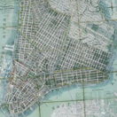
The OASIS site in partnership with New York Public Library allows juxtapositions of some of the more interesting historical maps that have been digitized allowing the user to see what happened over time. Shown overlaid here on the Manhattan Street Grid are: (i) John Montresor's map (considered one of the best depictions of New York in 1775 and used by the British during the Revolutionary War); (ii) Thomas Poppleton's Map of 1817 (which surveyed New York's shoreline); (iii) civil engineer Egbert Ludovicus Viele's Sanitary and Topographical map of 1865 (which shows the original waterways, making it still very useful for structural engineers to use to design foundations).
Credits:
The www.OASISnyc.net maps are maintained by the CUNY Mapping Service at the Center for Urban Research, CUNY Graduate Center, on behalf of the Open Accessible Space Information System (OASIS) Steering Committee.
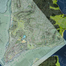
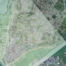
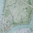


Montresor Map (1775) superimposed over Mannahatta (1609)


